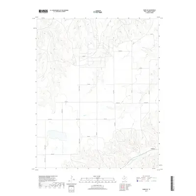
2019 Map of Pampa NE
USGS Topo · Published 2019About this map
Codman sits on the high plains of Roberts County, overlooking the broken terrain where the Red Deer Cr valley begins its descent. This landscape is defined by the sharp transition between level ranchlands and the dendritic drainage patterns of Indian Cr and Bluff Cr. The map reveals a highly structured grid of named rural routes, including Turkey Track Rd and Bean Rd, which provide access to this corner of the Texas Panhandle. These roads follow the section lines across the plateau but must adapt to the natural contours as they approach the creek beds. The naming of roads like Haggard Rd and Nelson Rd suggests a landscape tied to specific landholdings and long-standing ranching operations characteristic of this region.
Find a feature on this map
20 named features on this map. Tap any name to fly to it.
Don’t see what you’re looking for? This feature index may not catch every label — zoom into the map to look around manually.
Map Details
Editions of this 2019 Pampa NE Map
This is the sole edition of this map. No revisions or reprints were ever made.
Other maps of this area

1954 · Amarillo
USGS Topo · 1:250,000

1958 · Amarillo
USGS Topo · 1:250,000

1963 · Pampa
USGS Topo · 1:24,000

1966 · Laketon
USGS Topo · 1:24,000

1967 · Hoover
USGS Topo · 1:24,000

1971 · Dry Creek South
USGS Topo · 1:24,000

1971 · Dry Creek SE
USGS Topo · 1:24,000

1971 · Pampa NW
USGS Topo · 1:24,000

1972 · Pampa NE
USGS Topo · 1:24,000

1972 · Miami
USGS Topo · 1:24,000