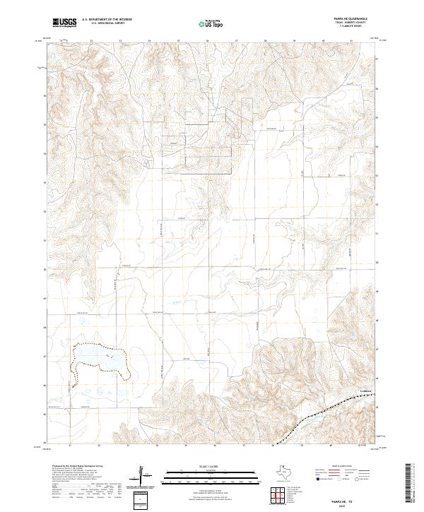
2022 Map of Pampa NE
USGS Topo · Published 2022About this map
The high plains of Roberts County, Texas, define this landscape, where the rolling breaks of the Canadian River watershed give way to seasonal watercourses. Indian Cr and Bluff Cr carve subtle drainage patterns through the terrain, eventually feeding into the larger valley of Red Deer Cr in the southeastern portion of the map. The settlement at Codman sits along these lower elevations, representing a localized point of interest in an otherwise rural expanse dominated by cattle ranching and energy interests.
Find a feature on this map
20 named features on this map. Tap any name to fly to it.
Don’t see what you’re looking for? This feature index may not catch every label — zoom into the map to look around manually.
Map Details
Editions of this 2022 Pampa NE Map
This is the sole edition of this map. No revisions or reprints were ever made.
Other maps of this area

1954 · Amarillo
USGS Topo · 1:250,000

1958 · Amarillo
USGS Topo · 1:250,000

1963 · Pampa
USGS Topo · 1:24,000

1966 · Laketon
USGS Topo · 1:24,000

1967 · Hoover
USGS Topo · 1:24,000

1971 · Dry Creek South
USGS Topo · 1:24,000

1971 · Dry Creek SE
USGS Topo · 1:24,000

1971 · Pampa NW
USGS Topo · 1:24,000

1972 · Pampa NE
USGS Topo · 1:24,000

1972 · Miami
USGS Topo · 1:24,000