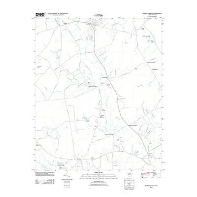
2011 Map of Pamplico South
USGS Topo · Published 2011About this map
Pamplico and the surrounding rural landscape of Florence County are defined by a complex network of wetlands and small agricultural settlements. The terrain is characterized by large, shallow depressions known locally as bays, including Myers Bay and Cockfield Bay, which punctuate the drainage basins of Big Swamp Branch and Cypress Branch. Along the Lynches River and the Great Pee Dee River, the map documents numerous private impoundments such as Richard Holliday Pond and Floyd Pond, reflecting the long-standing management of these waterways for local utility.
Find a feature on this map
120 named features on this map. Tap any name to fly to it.
Don’t see what you’re looking for? This feature index may not catch every label — zoom into the map to look around manually.
Map Details
Editions of this 2011 Pamplico South Map
This is the sole edition of this map. No revisions or reprints were ever made.
Other maps of this area

1940 · Florence East
USGS Topo · 1:62,500

1945 · Florence East
USGS Topo · 1:62,500

1946 · Hyman
USGS Topo · 1:62,500

1946 · Johnsonville
USGS Topo · 1:62,500

1947 · Friendship
USGS Topo · 1:24,000

1949 · Georgetown
USGS Topo · 1:250,000

1953 · Florence
USGS Topo · 1:250,000

1954 · Florence
USGS Topo · 1:250,000

1967 · Georgetown
USGS Topo · 1:250,000

1974 · Georgetown
USGS Topo · 1:250,000