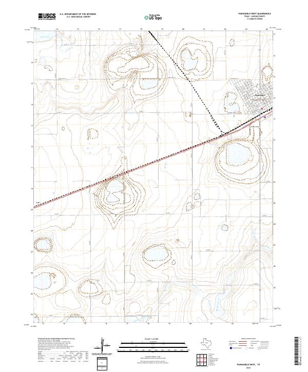
2022 Map of Panhandle West
USGS Topo · Published 2022About this map
Panhandle serves as the focal point of this Carson County landscape, oriented around the prominent Carson County Courthouse and a grid of residential streets including Main St, Euclid Ave, and Goddard Ave. The surrounding High Plains terrain is defined by its agricultural and transit layout, with a dense network of county roads such as Co RD 13 and Co RD 11 intersecting the open prairie. Southwest of the town center lies Stamps Field, while the western edge of the quadrangle reaches the small community of Lee. Natural drainage patterns are visible through the winding course of McClellan Creek to the south and the presence of Pantex Lake in the northwest corner. This 2022 survey captures the modern geography of a traditional Texas Panhandle rail and ranching hub, showing the continued importance of regional routes like Ranch Rd 293.
Find a feature on this map
48 named features on this map. Tap any name to fly to it.
Don’t see what you’re looking for? This feature index may not catch every label — zoom into the map to look around manually.
Map Details
Editions of this 2022 Panhandle West Map
This is the sole edition of this map. No revisions or reprints were ever made.
Other maps of this area

1953 · Pomeroy
USGS Topo · 1:24,000

1953 · Sevenmile Basin
USGS Topo · 1:24,000

1954 · Amarillo
USGS Topo · 1:250,000

1956 · Washburn
USGS Topo · 1:24,000

1958 · Amarillo
USGS Topo · 1:250,000

1960 · Claude
USGS Topo · 1:62,500

1965 · Abell
USGS Topo · 1:24,000

1966 · Panhandle West
USGS Topo · 1:24,000

1966 · Panhandle East
USGS Topo · 1:24,000

1966 · Cuyler
USGS Topo · 1:24,000