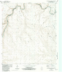
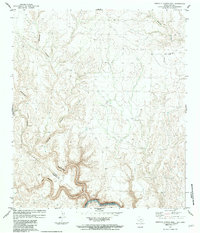
1983 Map of Panther Gulch East
USGS Topo · Published 1984About this map
The Rio Grande Rio Bravo carves a deep, winding boundary between the United States of America and Mexico in this 1980s topographical study. This section of the border, where Brewster County meets Terrell County in Texas, is defined by an intricate network of desert canyons and high plateaus. Landforms like Mesa Juan Botas and the Sierra La Chulita dominate the landscape, reflecting a remote region where infrastructure is minimal. Human activity is evidenced primarily by several Landing Strips and the presence of La Chulita. The map provides a look at the arid drainage systems of San Juan and San Francisco, which feed toward the international line. This survey, compiled from 1974 aerial photography and later field checks, captures the precise topography of the Big Bend region just after the treaty of 1970 established the modern river boundary.
Find a feature on this map
21 named features on this map. Tap any name to fly to it.
Don’t see what you’re looking for? This feature index may not catch every label — zoom into the map to look around manually.
Map Details
Editions of this 1983 Panther Gulch East Map
This is the sole edition of this map. No revisions or reprints were ever made.
Other maps of this area

1918 · Dryden Crossing
USGS Topo · 1:62,500

1918 · Indian Wells
USGS Topo · 1:62,500

1959 · Emory Peak
USGS Topo · 1:250,000

1965 · Emory Peak
USGS Topo · 1:250,000
1983 · Panther Gulch West
USGS Topo · 1:24,000
1983 · Candilla Canyon West
USGS Topo · 1:24,000
1983 · Taylor Canyon
USGS Topo · 1:24,000
1983 · Candilla Canyon East
USGS Topo · 1:24,000
1983 · McClain Canyon
USGS Topo · 1:24,000
1985 · Dove Mountain
USGS Topo · 1:100,000