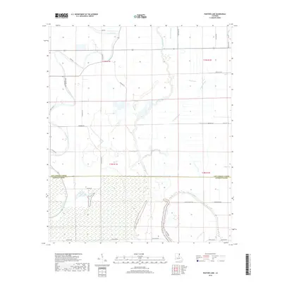
2018 Map of Panther Lake
USGS Topo · Published 2018About this map
Joes Bayou and Tensas Bayou wind through this alluvial landscape, defining the hydrology of the East Carroll and Madison Parish border. The terrain is a network of watercourses and managed drainage, where features like Valentine Ditch and Sassafras Bayou cut through the lowland plains. The area is characterized by large agricultural tracts and a dispersed road system, including the aptly named Panther Rd leading toward Panther Lake. A mix of local names like Maiden Doe Bayou and Graveyard Bayou suggests a deep history of navigation and land use in this corner of the Louisiana Delta. Roads such as Teddy Roosevelt Rd and Brown Drane Rd provide access to the wetlands and seasonal floodplains that dominate the southern portion of the quadrangle near Bull Bayou.
Find a feature on this map
39 named features on this map. Tap any name to fly to it.
Don’t see what you’re looking for? This feature index may not catch every label — zoom into the map to look around manually.
Map Details
Editions of this 2018 Panther Lake Map
This is the sole edition of this map. No revisions or reprints were ever made.
Other maps of this area

1909 · Tallulah
USGS Topo · 1:24,000

1935 · Waverly
USGS Topo · 1:62,500

1939 · Talla Bena
USGS Topo · 1:62,500

1939 · Alsatia
USGS Topo · 1:62,500

1955 · Jackson
USGS Topo · 1:250,000

1959 · Mitchiner
USGS Topo · 1:62,500

1961 · Jackson
USGS Topo · 1:250,000

1961 · Waverly
USGS Topo · 1:62,500

1962 · Jackson
USGS Topo · 1:250,000
1963 · Tallulah
USGS Topo · 1:24,000