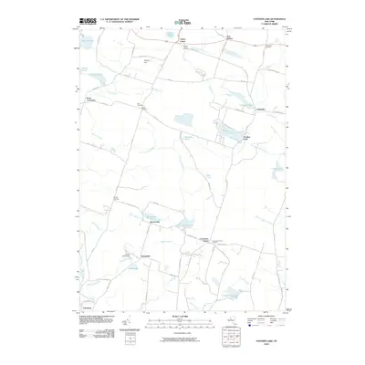
2010 Map of Panther Lake
USGS Topo · Published 2010About this map
Amboy Center and East Amboy sit at the northern edge of this landscape, where small crossroads communities are linked by a web of county routes and rural roads. The area is defined by a dense network of water bodies and wetlands, ranging from the prominent Panther Lake and Kibbie Lake to smaller reaches like Dutcher Pond and Francis Pond. This aquatic geography is tied together by numerous seasonal and permanent flows, including the Little River, Scriba Creek, and Crandall Creek. Local history is preserved in small family and community burial grounds such as Hall Cemetery and the Amboy Center Cemetery. Further south, the map details established settlements like Dutcherville and Nicholsville near Camp Woodland, illustrating a settlement pattern deeply influenced by the many creeks and brooks that drain toward the Constantia area.
Find a feature on this map
70 named features on this map. Tap any name to fly to it.
Don’t see what you’re looking for? This feature index may not catch every label — zoom into the map to look around manually.
Map Details
Editions of this 2010 Panther Lake Map
This is the sole edition of this map. No revisions or reprints were ever made.
Other maps of this area

1895 · Chittenango
USGS Topo · 1:62,500

1895 · Syracuse
USGS Topo · 1:62,500

1898 · Syracuse
USGS Topo · 1:62,500

1898 · Chittenango
USGS Topo · 1:62,500

1902 · Chittenango
USGS Topo · 1:62,500

1905 · Mexico
USGS Topo · 1:62,500

1906 · Kasoag
USGS Topo · 1:62,500

1940 · Cicero
USGS Topo · 1:24,000

1941 · Cleveland
USGS Topo · 1:24,000

1941 · Jewell
USGS Topo · 1:24,000