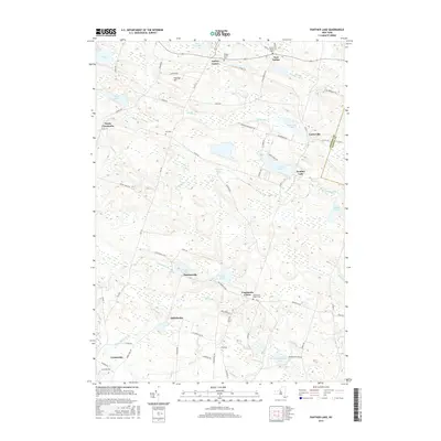
2016 Map of Panther Lake
USGS Topo · Published 2016About this map
Amboy Center and East Amboy anchor the northern landscape of this Oswego and Oneida county border region, where a dense network of water bodies and marshy lowlands defines the local geography. The area's settlement pattern is closely tied to its hydrography, with communities like Carterville established near Carterville Pond and the Little River. Further south, the rural hamlets of Dutcherville, Nicholsville, and Constantia Center are connected by a web of local routes such as Co Rte 17 and Dutcherville Rd.
Find a feature on this map
80 named features on this map. Tap any name to fly to it.
Don’t see what you’re looking for? This feature index may not catch every label — zoom into the map to look around manually.
Map Details
Editions of this 2016 Panther Lake Map
This is the sole edition of this map. No revisions or reprints were ever made.
Other maps of this area

1895 · Chittenango
USGS Topo · 1:62,500

1895 · Syracuse
USGS Topo · 1:62,500

1898 · Syracuse
USGS Topo · 1:62,500

1898 · Chittenango
USGS Topo · 1:62,500

1902 · Chittenango
USGS Topo · 1:62,500

1905 · Mexico
USGS Topo · 1:62,500

1906 · Kasoag
USGS Topo · 1:62,500

1940 · Cicero
USGS Topo · 1:24,000

1941 · Cleveland
USGS Topo · 1:24,000

1941 · Jewell
USGS Topo · 1:24,000