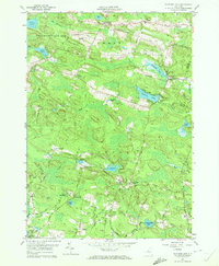
1959 Map of Panther Lake
USGS Topo · Published 1972About this map
Panther Lake and the surrounding woodlands of northern Oswego County are captured here during a period of reforestation and rural transition. The landscape is defined by its numerous small bodies of water, including Carterville Pond, Dutcher Pond, and the secluded Vanderkamp Lake. In the northern section, a large State Reforestation Area indicates the conversion of former farmland back to forest, while the presence of an Old Railroad Grade near Constantia serves as a reminder of the region's earlier industrial logging or transit history.
Find a feature on this map
81 named features on this map. Tap any name to fly to it.
Don’t see what you’re looking for? This feature index may not catch every label — zoom into the map to look around manually.
Map Details
Editions of this 1959 Panther Lake Map
3 editions found
Other maps of this area

1895 · Chittenango
USGS Topo · 1:62,500

1895 · Syracuse
USGS Topo · 1:62,500

1898 · Syracuse
USGS Topo · 1:62,500

1898 · Chittenango
USGS Topo · 1:62,500

1902 · Chittenango
USGS Topo · 1:62,500

1905 · Mexico
USGS Topo · 1:62,500

1906 · Kasoag
USGS Topo · 1:62,500

1940 · Cicero
USGS Topo · 1:24,000

1941 · Cleveland
USGS Topo · 1:24,000

1941 · Jewell
USGS Topo · 1:24,000