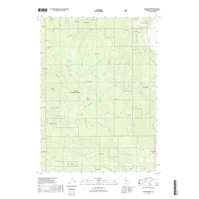
2018 Map of Panther Rock
USGS Topo · Published 2018About this map
Klamath National Forest dominates this high-altitude landscape in Siskiyou County, where the headwaters of the Little Shasta River begin their descent. The terrain is defined by a series of prominent peaks and ridges, including Ball Mtn, Butte Mtn, and the distinctive Panther Rock. This area serves as a critical watershed, dotted with numerous water sources like Smith Springs and Cold Bottle Spring that feed into the surrounding meadows.
Find a feature on this map
46 named features on this map. Tap any name to fly to it.
Don’t see what you’re looking for? This feature index may not catch every label — zoom into the map to look around manually.
Map Details
Editions of this 2018 Panther Rock Map
This is the sole edition of this map. No revisions or reprints were ever made.
Other maps of this area

1886 · Shasta
USGS Topo · 1:250,000

1894 · Shasta
USGS Topo · 1:250,000

1934 · Macdoel
USGS Topo · 1:96,000

1941 · Macdoel
USGS Topo · 1:125,000

1948 · Weed
USGS Topo · 1:250,000

1950 · Weed
USGS Topo · 1:250,000

1954 · The Whaleback
USGS Topo · 1:62,500

1954 · Macdoel
USGS Topo · 1:62,500
1954 · Copco
USGS Topo · 1:62,500
1954 · Dwinnell Reservoir
USGS Topo · 1:62,500