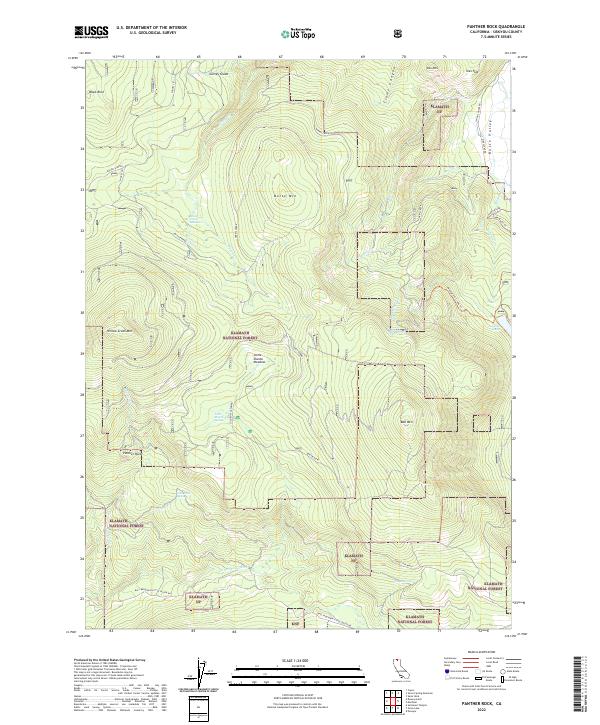
2022 Map of Panther Rock
USGS Topo · Published 2022About this map
Panther Rock and the high ridges of the Klamath NF define this high-elevation landscape in Northern California. The terrain is a network of volcanic peaks and alpine basins, where drainage systems like Shovel Cr and Harris Cr flow through specialized environments such as Shovel Creek Meadows and Garvey Glade. Human use of the land is visible through resource-focused infrastructure, notably the Juanita Lake Flume and the seasonal access provided by Martin Dairy. To the east, the map transitions toward the edge of Butte Valley, where more established routes like School House Rd and Meiss Lake Rd hint at the valley's agricultural and ranching history. This survey provides a look at the remote mountain interior, tracking the headwaters of the Little Shasta River and various high-country springs including Cold Bottle Spring and Smith Springs.
Find a feature on this map
43 named features on this map. Tap any name to fly to it.
Don’t see what you’re looking for? This feature index may not catch every label — zoom into the map to look around manually.
Map Details
Editions of this 2022 Panther Rock Map
This is the sole edition of this map. No revisions or reprints were ever made.
Other maps of this area

1886 · Shasta
USGS Topo · 1:250,000

1894 · Shasta
USGS Topo · 1:250,000

1934 · Macdoel
USGS Topo · 1:96,000

1941 · Macdoel
USGS Topo · 1:125,000

1948 · Weed
USGS Topo · 1:250,000

1950 · Weed
USGS Topo · 1:250,000

1954 · The Whaleback
USGS Topo · 1:62,500

1954 · Macdoel
USGS Topo · 1:62,500
1954 · Copco
USGS Topo · 1:62,500
1954 · Dwinnell Reservoir
USGS Topo · 1:62,500