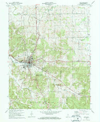
1970 Map of Paoli
USGS Topo · Published 1972About this map
Paoli serves as the hub of this 1970 landscape, where the Monon railroad corridor meets a complex network of rural churches and cemeteries. The terrain is defined by the subterranean drainage of the Stampers Creek Sinks and the protected stands of the Pioneer Mothers Memorial Forest. To the south, the Hoosier National Forest covers the uplands, while small outlying settlements like Chambersburg and Syria anchor the surrounding townships.
Find a feature on this map
48 named features on this map. Tap any name to fly to it.
Don’t see what you’re looking for? This feature index may not catch every label — zoom into the map to look around manually.
Map Details
Editions of this 1970 Paoli Map
3 editions found
Other maps of this area

1947 · Hardinsburg
USGS Topo · 1:24,000

1949 · Hardinsburg
USGS Topo · 1:24,000

1949 · Georgia
USGS Topo · 1:24,000

1950 · Mitchell
USGS Topo · 1:24,000

1950 · Valeene
USGS Topo · 1:24,000

1951 · French Lick
USGS Topo · 1:24,000

1951 · Georgia
USGS Topo · 1:24,000

1956 · Greenbrier
USGS Topo · 1:24,000

1956 · Vincennes
USGS Topo · 1:250,000

1957 · Vincennes
USGS Topo · 1:250,000