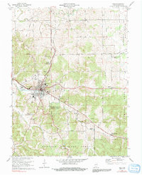
1970 Map of Paoli
USGS Topo · Published 1991About this map
Paoli serves as the central hub for this Orange County landscape, where the Monon railroad corridor cuts through town near Braxtons Siding. The town is well-established with civic landmarks like the Paoli Municipal Airport, the Athletic Field, and educational sites including Throop Memorial Sch and the local High Sch. To the south and east, the terrain transitions into the dense woodlands of the Pioneer Mothers Memorial Forest and the northern reaches of the Hoosier National Forest.
Find a feature on this map
56 named features on this map. Tap any name to fly to it.
Don’t see what you’re looking for? This feature index may not catch every label — zoom into the map to look around manually.
Map Details
Editions of this 1970 Paoli Map
3 editions found
Other maps of this area

1947 · Hardinsburg
USGS Topo · 1:24,000

1949 · Hardinsburg
USGS Topo · 1:24,000

1949 · Georgia
USGS Topo · 1:24,000

1950 · Mitchell
USGS Topo · 1:24,000

1950 · Valeene
USGS Topo · 1:24,000

1951 · French Lick
USGS Topo · 1:24,000

1951 · Georgia
USGS Topo · 1:24,000

1956 · Greenbrier
USGS Topo · 1:24,000

1956 · Vincennes
USGS Topo · 1:250,000

1957 · Vincennes
USGS Topo · 1:250,000