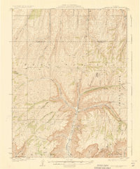
1927 Map of Parachute Creek
USGS Topo · Published 1927About this map
The Naval Oil Shale Reserve dominates this 1920s landscape, reflecting an era when federal energy security was focused on the strategic potential of the Western Slope's oil shale deposits. Located along the boundary of Rio Blanco and Garfield Counties, the area is defined by the massive Book Cliffs and a complex drainage network feeding into Parachute Creek. Remote outposts such as Columbia Shale Camp and Washington Shale Camp indicate the early industrial presence in these deep canyons, while Granlee School and family-named landmarks like Granlee Gulch and Summers Cabin point to the scattered ranching and homesteading families who inhabited the high plateaus. Historic movement through the terrain is marked by the Eaton Trail, connecting the high ridges above Willow Creek and Bear Creek to the valley floors.
Find a feature on this map
54 named features on this map. Tap any name to fly to it.
Don’t see what you’re looking for? This feature index may not catch every label — zoom into the map to look around manually.
Map Details
Editions of this 1927 Parachute Creek Map
3 editions found
Other maps of this area

1906 · Grand Hogback
USGS Topo · 1:125,000

1910 · Grand Hogback
USGS Topo · 1:125,000

1925 · Parachute Creek
USGS Topo · 1:62,500

1927 · Parachute Creek
USGS Topo · 1:62,500

1929 · Grand Valley
USGS Topo · 1:62,500

1929 · Highmore
USGS Topo · 1:62,500

1929 · Roan Creek
USGS Topo · 1:62,500

1952 · Rio Blanco
USGS Topo · 1:24,000

1952 · Anvil Points
USGS Topo · 1:24,000

1952 · Rock School
USGS Topo · 1:24,000