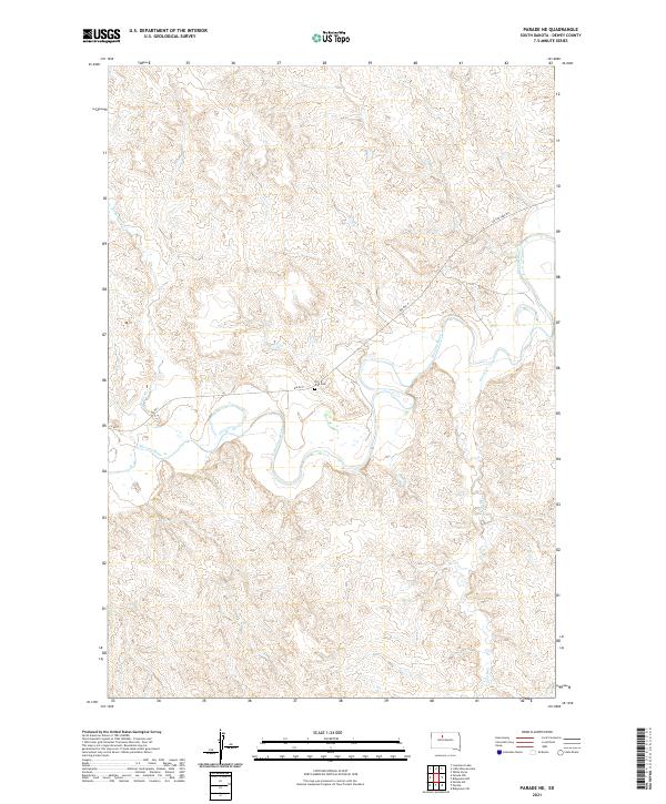
2021 Map of Parade NE
USGS Topo · Published 2021About this map
The Moreau River defines the central topography of this Dewey County landscape, carving a winding path through the prairie of the Cheyenne River Reservation. Near a sharp northward bend in the river, the On-a-Tree Cem sits as a significant cultural and genealogical landmark, adjacent to Bia Rd 2. The surrounding terrain is characterized by the confluence of several tributaries, including Redwater Cr and Goose Cr, which feed into the main river channel. The road network, including the evocatively named On the Tree Rd and various Bureau of Indian Affairs routes like Bia Rte 2, reflects the managed infrastructure of the reservation. This 2021 update documents the contemporary drainage patterns and land divisions of the Cheyenne River Sioux Tribe's territory, providing a precise look at the rural landscape and its enduring indigenous heritage.
Find a feature on this map
13 named features on this map. Tap any name to fly to it.
Don’t see what you’re looking for? This feature index may not catch every label — zoom into the map to look around manually.
Map Details
Editions of this 2021 Parade NE Map
This is the sole edition of this map. No revisions or reprints were ever made.
Other maps of this area

1951 · Ridgeview NW
USGS Topo · 1:24,000

1952 · Whitehorse
USGS Topo · 1:24,000

1952 · Parade NE
USGS Topo · 1:24,000

1952 · Parade NW
USGS Topo · 1:24,000

1953 · McIntosh
USGS Topo · 1:250,000

1958 · McIntosh
USGS Topo · 1:250,000

1978 · Little Moreau Lake
USGS Topo · 1:24,000

1978 · Livermant Lake
USGS Topo · 1:24,000

1981 · Parade SW
USGS Topo · 1:24,000
1981 · Parade
USGS Topo · 1:24,000