
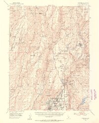
1953 Map of Paradise
USGS Topo · Published 1961About this map
Paradise and the surrounding Sierra Nevada foothills are captured here during a period of transition in the mid-twentieth century. The landscape is defined by its industrial roots, with the Southern Pacific railroad line threading through the region and numerous mining operations like the Royal Drift Mine and Magalia Mine scattered among the ridges. Large tracts of the Lassen National Forest dominate the northern and eastern portions of the map, while the historical Bidwell Grant Boundary reflects the legacy of early California land holdings near Arroyo Chico.
Find a feature on this map
75 named features on this map. Tap any name to fly to it.
Don’t see what you’re looking for? This feature index may not catch every label — zoom into the map to look around manually.
Map Details
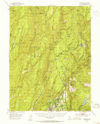
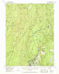
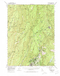
Editions of this 1953 Paradise Map
5 editions found
Historical Maps of Chico Through Time
1 maps found