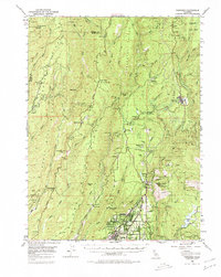
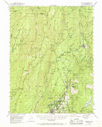
1953 Map of Paradise
USGS Topo · Published 1980About this map
Stirling City and the growing community of Paradise anchor this mid-century portrait of the Sierra Nevada foothills, a landscape defined by its deep canyons and a legacy of resource extraction. The map details the intricate water and power network of the era, from the Magalia Reservoir to the Power House at Centerville. Gold mining history is deeply etched into the terrain, evidenced by numerous labeled sites like the Royal Drift Mine and Old Utah Mine, as well as several early settlements marked as sites, including Helltown and Toadtown.
Find a feature on this map
76 named features on this map. Tap any name to fly to it.
Don’t see what you’re looking for? This feature index may not catch every label — zoom into the map to look around manually.
Map Details
Editions of this 1953 Paradise Map
5 editions found
Other maps of this area

1886 · Lassen Peak
USGS Topo · 1:250,000

1888 · Bidwell Bar
USGS Topo · 1:125,000

1891 · Bidwell Bar
USGS Topo · 1:125,000

1891 · Chico
USGS Topo · 1:125,000

1892 · Lassen Peak
USGS Topo · 1:250,000

1893 · Chico
USGS Topo · 1:125,000

1893 · Bidwell Bar
USGS Topo · 1:125,000

1894 · Lassen Peak
USGS Topo · 1:250,000

1895 · Bidwell Bar
USGS Topo · 1:125,000

1895 · Chico
USGS Topo · 1:125,000