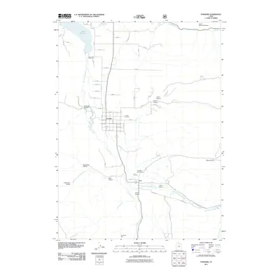
2011 Map of Paradise
USGS Topo · Published 2011About this map
The Little Bear River and its various forks dominate this southern Cache Valley landscape, carving through a series of canyons and hollows near the settlements of Paradise and Avon. In the northern section, the Hyrum Reservoir serves as a primary geographical anchor, supported by the Hyrum Lake Campground for local recreation. The map reveals a distinct transition from the grid-iron residential streets of Paradise to the more dispersed agricultural layout near Avon to the south.
Find a feature on this map
66 named features on this map. Tap any name to fly to it.
Don’t see what you’re looking for? This feature index may not catch every label — zoom into the map to look around manually.
Map Details
Editions of this 2011 Paradise Map
This is the sole edition of this map. No revisions or reprints were ever made.
Other maps of this area

1914 · Logan
USGS Topo · 1:125,000

1916 · Logan
USGS Topo · 1:125,000

1954 · Ogden
USGS Topo · 1:250,000

1955 · Paradise
USGS Topo · 1:24,000

1955 · Mantua
USGS Topo · 1:24,000

1955 · James Peak
USGS Topo · 1:24,000

1955 · Mount Pisgah
USGS Topo · 1:24,000

1958 · Ogden
USGS Topo · 1:250,000

1960 · Ogden
USGS Topo · 1:250,000

1961 · Logan
USGS Topo · 1:24,000