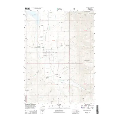
2014 Map of Paradise
USGS Topo · Published 2014About this map
The Little Bear River and its multiple forks define the settlement patterns of this Cache County valley, where the towns of Hyrum, Paradise, and Avon occupy a fertile corridor between the high peaks of the Wasatch Range and the Cache National Forest. In the northern reach, the Hyrum Reservoir serves as a major hydrological anchor, supported by an intricate network of irrigation features including the Hyrum Canal and O'Berry Canal. This 2014 survey reveals the proximity of these rural communities to the steep terrain of the mountains, with McMurdie Hollow, Green Canyon, and Paradise Dry Canyon cutting into the eastern uplands. For those researching local heritage, the map identifies the Paradise Cem and Avon Cem, while landmarks such as McKenzie Mtn and Fourmile Hill overlook the southern flats of McKenzie Flat.
Find a feature on this map
41 named features on this map. Tap any name to fly to it.
Don’t see what you’re looking for? This feature index may not catch every label — zoom into the map to look around manually.
Map Details
Editions of this 2014 Paradise Map
This is the sole edition of this map. No revisions or reprints were ever made.
Other maps of this area

1914 · Logan
USGS Topo · 1:125,000

1916 · Logan
USGS Topo · 1:125,000

1954 · Ogden
USGS Topo · 1:250,000

1955 · Paradise
USGS Topo · 1:24,000

1955 · Mantua
USGS Topo · 1:24,000

1955 · James Peak
USGS Topo · 1:24,000

1955 · Mount Pisgah
USGS Topo · 1:24,000

1958 · Ogden
USGS Topo · 1:250,000

1960 · Ogden
USGS Topo · 1:250,000

1961 · Logan
USGS Topo · 1:24,000