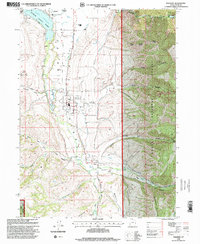
1998 Map of Paradise
USGS Topo · Published 2001About this map
Paradise and the neighboring settlement of Avon anchor this study of southern Cache Valley as it appeared at the turn of the millennium. The landscape is defined by the sophisticated irrigation network supporting the valley floor, including the Highline Canal, Jackson Ditch, and Western Canal systems. These man-made watercourses run parallel to the natural flow of the Little Bear River and Blacksmith Fork, illustrating the region's long-standing reliance on managed water for agriculture and growth. To the north, Hyrum Reservoir and the adjacent Hyrum State Park provide a clear contrast between the developed valley and the steep, rising slopes of the Cache National Forest. In the higher elevations to the east and south, family-named landmarks like McMurdie Hollow and McKenzie Mountain mark the transition into the canyon country of Paradise Dry Canyon and Green Canyon.
Find a feature on this map
38 named features on this map. Tap any name to fly to it.
Don’t see what you’re looking for? This feature index may not catch every label — zoom into the map to look around manually.
Map Details
Editions of this 1998 Paradise Map
This is the sole edition of this map. No revisions or reprints were ever made.
Other maps of this area

1914 · Logan
USGS Topo · 1:125,000

1916 · Logan
USGS Topo · 1:125,000

1954 · Ogden
USGS Topo · 1:250,000

1955 · Paradise
USGS Topo · 1:24,000

1955 · Mantua
USGS Topo · 1:24,000

1955 · James Peak
USGS Topo · 1:24,000

1955 · Mount Pisgah
USGS Topo · 1:24,000

1958 · Ogden
USGS Topo · 1:250,000

1960 · Ogden
USGS Topo · 1:250,000

1961 · Logan
USGS Topo · 1:24,000