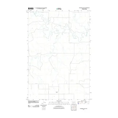
2011 Map of Paradise Flats
USGS Topo · Published 2011About this map
The Cannonball River meanders across this rural North Dakota landscape, carving a series of dramatic loops and oxbows through the plains of Grant County. This early 21st-century survey highlights the sparsely settled nature of the region, where the terrain is dominated by the namesake Paradise Flats in the southern portion of the quadrangle. The river system is supported by tributaries like Snake Creek and Boxelder Creek, which drain the open prairie.
Find a feature on this map
18 named features on this map. Tap any name to fly to it.
Don’t see what you’re looking for? This feature index may not catch every label — zoom into the map to look around manually.
Map Details
Editions of this 2011 Paradise Flats Map
This is the sole edition of this map. No revisions or reprints were ever made.
Other maps of this area

1954 · Bismarck
USGS Topo · 1:250,000

1958 · Bismarck
USGS Topo · 1:250,000

1971 · Lookout Butte
USGS Topo · 1:24,000

1972 · Carson SE
USGS Topo · 1:24,000

1972 · Leith
USGS Topo · 1:24,000

1972 · Paradise Flats
USGS Topo · 1:24,000

1972 · Wheeler Hills
USGS Topo · 1:24,000
1972 · Pitt Creek
USGS Topo · 1:24,000
1972 · Parks Hills
USGS Topo · 1:24,000

1980 · Brisbane
USGS Topo · 1:24,000