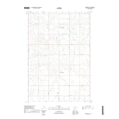
2017 Map of Paradise Flats
USGS Topo · Published 2017About this map
Paradise Flats defines the high ground of this Grant County landscape, where the open prairie is dissected by an intricate network of waterways. The Cannonball River meanders across the northern and eastern reaches of the map, carving a winding path through the terrain. Tributaries like Snake Creek and Boxelder Creek further define the drainage patterns of the area, creating a complex series of coulees and draws that contrast with the flatter plateau of the namesake flats.
Find a feature on this map
19 named features on this map. Tap any name to fly to it.
Don’t see what you’re looking for? This feature index may not catch every label — zoom into the map to look around manually.
Map Details
Editions of this 2017 Paradise Flats Map
This is the sole edition of this map. No revisions or reprints were ever made.
Other maps of this area

1954 · Bismarck
USGS Topo · 1:250,000

1958 · Bismarck
USGS Topo · 1:250,000

1971 · Lookout Butte
USGS Topo · 1:24,000

1972 · Carson SE
USGS Topo · 1:24,000

1972 · Leith
USGS Topo · 1:24,000

1972 · Paradise Flats
USGS Topo · 1:24,000

1972 · Wheeler Hills
USGS Topo · 1:24,000
1972 · Pitt Creek
USGS Topo · 1:24,000
1972 · Parks Hills
USGS Topo · 1:24,000

1980 · Brisbane
USGS Topo · 1:24,000