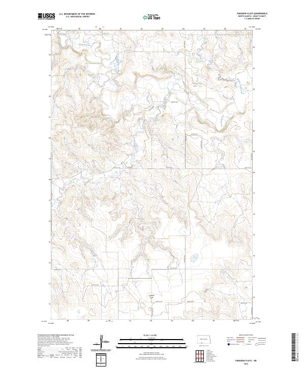
2024 Map of Paradise Flats
USGS Topo · Published 2024About this map
The Cannonball River meanders across the northern section of this Grant County landscape, defining a terrain shaped by dramatic drainage systems. The settlement of Paradise Flats sits in the southern portion of the quadrangle, positioned near the junction of 89th St SW and 57th Ave SW. This contemporary survey reveals a highly organized grid of rural section lines and local roads, such as Watauga Rd, which overlay a complex network of seasonal watercourses. Significant tributaries including Snake Creek and Boxelder Creek carve deep into the plateau, illustrating the erosive power of the regional watershed. The map details the transition between these elevated flats and the river valley, documenting the modern road network that connects isolated farmsteads and agricultural parcels across the North Dakota prairie.
Find a feature on this map
18 named features on this map. Tap any name to fly to it.
Don’t see what you’re looking for? This feature index may not catch every label — zoom into the map to look around manually.
Map Details
Editions of this 2024 Paradise Flats Map
This is the sole edition of this map. No revisions or reprints were ever made.
Other maps of this area

1954 · Bismarck
USGS Topo · 1:250,000

1958 · Bismarck
USGS Topo · 1:250,000

1971 · Lookout Butte
USGS Topo · 1:24,000

1972 · Carson SE
USGS Topo · 1:24,000

1972 · Leith
USGS Topo · 1:24,000

1972 · Paradise Flats
USGS Topo · 1:24,000

1972 · Wheeler Hills
USGS Topo · 1:24,000
1972 · Pitt Creek
USGS Topo · 1:24,000
1972 · Parks Hills
USGS Topo · 1:24,000

1980 · Brisbane
USGS Topo · 1:24,000