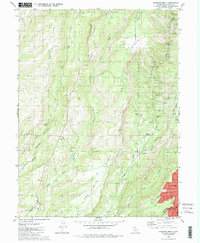
1980 Map of Paradise West
USGS Topo · Published 1984About this map
Doe Mill Ridge and Musty Buck Ridge dominate this portion of the northern California landscape, where deep canyons carved by Butte Creek and Chico Creek dictate the pattern of human settlement. The map documents a complex system of hydraulic infrastructure, including the Humbug Canal, Nimshew Canal, and several others that once served mining or agricultural interests. Industrial history is evident at the Indian Spring Mine and the De Sabla Powerhouse, while the emerging residential grid of Paradise begins to fill the southeastern corner of the sheet. Genealogists will find particular value in the locations of Centerville Cemetery and Nicholl Cem, alongside the remnants of early communities like the Helltown site and Irish Town. The western edge shows the upper reaches of Bidwell Park, tracing the rugged transition from the valley floor into the Sierra Nevada foothills.
Find a feature on this map
53 named features on this map. Tap any name to fly to it.
Don’t see what you’re looking for? This feature index may not catch every label — zoom into the map to look around manually.
Map Details
Editions of this 1980 Paradise West Map
4 editions found
Other maps of this area

1891 · Chico
USGS Topo · 1:125,000

1893 · Chico
USGS Topo · 1:125,000

1895 · Chico
USGS Topo · 1:125,000

1912 · Durham
USGS Topo · 1:31,680

1912 · Keefers
USGS Topo · 1:31,680

1912 · Clear Creek
USGS Topo · 1:31,680

1942 · Oroville
USGS Topo · 1:62,500
1944 · Oroville
USGS Topo · 1:62,500

1944 · Richardson Springs
USGS Topo · 1:62,500
1947 · Cherokee
USGS Topo · 1:24,000