
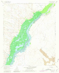
1961 Map of Paraje Well
USGS Topo · Published 1963About this map
Rio Grande waters dominate this 1961 survey of the Socorro County landscape, where the river's path is managed through a complex system including the Conveyance Channel and several miles of silt fence. The map centers on the northern reaches of the Elephant Butte Reservoir, showing the controlled inundation area and the spillway elevation. To the east, the terrain transitions into the desolate Jornada del Muerto and fields of lava, a stark contrast to the riparian corridor. Significant land divisions are represented by the Pedro Armendaris No 34 Grant, while the Atchison Topeka and Santa Fe railroad skirts the eastern volcanic formations. Numerous desert drainage features such as Lumbre Canyon, Simon Canyon, and Milligan Gulch illustrate the erosive forces shaping the mesas above the valley floor.
Find a feature on this map
21 named features on this map. Tap any name to fly to it.
Don’t see what you’re looking for? This feature index may not catch every label — zoom into the map to look around manually.
Map Details
Editions of this 1961 Paraje Well Map
2 editions found
Other maps of this area

1916 · Salinas Peak
USGS Topo · 1:125,000

1948 · Val Verde
USGS Topo · 1:62,500

1948 · Malpais Well
USGS Topo · 1:62,500

1954 · Tularosa
USGS Topo · 1:250,000

1958 · Tularosa
USGS Topo · 1:250,000

1961 · Hickman Ranch
USGS Topo · 1:24,000

1961 · Black Hill
USGS Topo · 1:24,000

1961 · Fort Craig
USGS Topo · 1:24,000

1961 · Lava
USGS Topo · 1:24,000

1961 · Romero Canyon
USGS Topo · 1:24,000