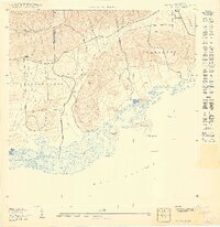
1949 Map of Parguera NO
USGS Topo · Published 1949About this map
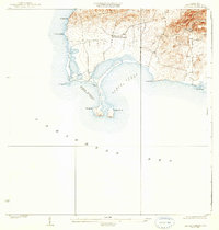
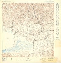
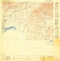
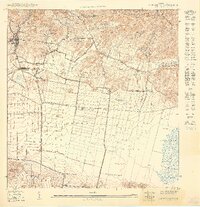
The hills of Sierra Bermeja define the northern horizon of this coastal landscape, which descends into the broad agricultural and salt-producing plains of southwest Puerto Rico. Along the rugged southern shoreline of the Mar Caribe, the map captures the intricate geography of the Salinas Pitajaya salt flats and the mangrove-lined coast near Pta Tocón. This 1949 edition shows the region's sparse development during the mid-century, centered around family-named landmarks like Rancho Cabassa and the topographical transition from the Llanos to the Llanos Costa. Off the coast, several islands including Isla Guayacán and Isla Cueva are mapped in detail, alongside landmarks such as Cayo Vieques and Pta Cueva de Ayala. The boundary between the Municipio de Cabo Rojo and Municipio de Lajas is clearly delineated as it cuts through the foothills of Palmarejo.
Find a feature on this map
18 named features on this map. Tap any name to fly to it.
Don’t see what you’re looking for? This feature index may not catch every label — zoom into the map to look around manually.
Map Details
Editions of this 1949 Parguera NO Map
This is the sole edition of this map. No revisions or reprints were ever made.
Other maps of this area

1935 · Puerto Real
USGS Topo · 1:25,000

1937 · San German
USGS Topo · 1:25,000

1937 · Puerto Real
USGS Topo · 1:25,000

1938 · Parguera
USGS Topo · 1:30,000
1938 · Cabo Rojo
USGS Topo · 1:30,000

1941 · San German
USGS Topo · 1:30,000

1941 · Puerto Real
USGS Topo · 1:30,000
1949 · Puerto Real SE
USGS Topo · 1:10,000
1949 · Cabo Rojo NE
USGS Topo · 1:10,000
1949 · San German SE
USGS Topo · 1:10,000