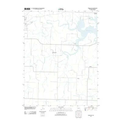
2012 Map of Paris East
USGS Topo · Published 2012About this map
The town of Paris serves as the western anchor for this landscape, where the Middle Fork Salt River and Elk Fork Salt River converge into the expansive waters of Mark Twain Lake. The terrain is defined by the winding drainages of Coon Creek and Brush Creek as they cut through the Mississippi River Hills. This era reflects a rural infrastructure centered on the small settlement of Strother and a network of county roads connecting family farms and historical burial sites. Genealogists and local historians will find several well-preserved landmarks, including Scobee Cemetery in the north and New Hope Cemetery to the south. The presence of the Samuel L Clemens Memorial Airport honors the region's most famous literary connection, while the inundation of the Salt River valley for the lake has fundamentally altered the local geography from its earlier settlement patterns.
Find a feature on this map
59 named features on this map. Tap any name to fly to it.
Don’t see what you’re looking for? This feature index may not catch every label — zoom into the map to look around manually.
Map Details
Editions of this 2012 Paris East Map
This is the sole edition of this map. No revisions or reprints were ever made.
Other maps of this area

1890 · Mexico
USGS Topo · 1:125,000

1890 · Moberly
USGS Topo · 1:125,000

1903 · Palmyra
USGS Topo · 1:125,000

1945 · Florida
USGS Topo · 1:62,500

1948 · Quincy
USGS Topo · 1:250,000

1953 · Moberly
USGS Topo · 1:250,000

1954 · Moberly
USGS Topo · 1:250,000

1956 · Quincy
USGS Topo · 1:250,000

1957 · Moberly
USGS Topo · 1:250,000

1960 · Moberly
USGS Topo · 1:250,000