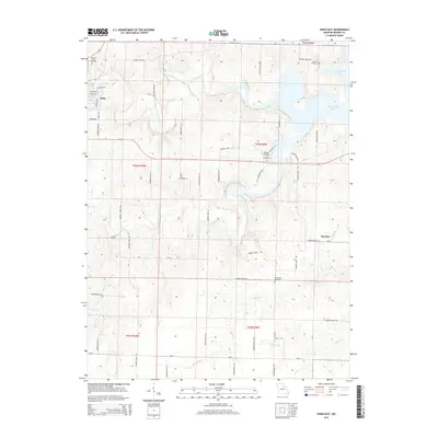
2015 Map of Paris East
USGS Topo · Published 2015About this map
Middle Fork Salt River and Elk Fork Salt River converge in this part of Monroe County, forming the headwaters of Mark Twain Lake. This landscape is defined by the hydrologic network of the Salt River system, with tributaries such as Brush Cr, Jordan Br, and Turkey Cr cutting through the terrain. The eastern edge of Paris is visible, showing a grid of streets including E Monroe St and S Fairview Ave, while the small settlement of Strother is situated to the southeast. Genealogists will find several burial grounds distributed across the township lines, including Walnut Grove Cemetery and Scobee Cemetery near the lake's northern fingers, as well as Pleasant Hill Cemetery and New Hope Cemetery further south. The map documents a predominantly rural expanse interlaced by an extensive system of secondary routes like Monroe Road 415 and Monroe Road 770.
Find a feature on this map
52 named features on this map. Tap any name to fly to it.
Don’t see what you’re looking for? This feature index may not catch every label — zoom into the map to look around manually.
Map Details
Editions of this 2015 Paris East Map
This is the sole edition of this map. No revisions or reprints were ever made.
Other maps of this area

1890 · Mexico
USGS Topo · 1:125,000

1890 · Moberly
USGS Topo · 1:125,000

1903 · Palmyra
USGS Topo · 1:125,000

1945 · Florida
USGS Topo · 1:62,500

1948 · Quincy
USGS Topo · 1:250,000

1953 · Moberly
USGS Topo · 1:250,000

1954 · Moberly
USGS Topo · 1:250,000

1956 · Quincy
USGS Topo · 1:250,000

1957 · Moberly
USGS Topo · 1:250,000

1960 · Moberly
USGS Topo · 1:250,000