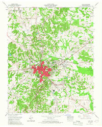
1965 Map of Paris
USGS Topo · Published 1967About this map
The Tennessee Valley Divide snakes across this Henry County landscape, separating the drainage systems of the Obion River to the south and west from the creeks flowing toward the Tennessee River. At the center, the city of Paris serves as a regional hub, its urban core concentrated around the Courthouse and Post Office while expanding outward into residential developments like Meadow Mead and Woodland Acres. The Louisville and Nashville railroad corridor remains a defining feature of the local economy, cutting through the heart of the city near the General Hospital.
Find a feature on this map
82 named features on this map. Tap any name to fly to it.
Don’t see what you’re looking for? This feature index may not catch every label — zoom into the map to look around manually.
Map Details
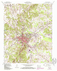
Editions of this 1965 Paris Map
2 editions found
Other maps of this area

1936 · Conyersville
USGS Topo · 1:24,000

1936 · Buchanan
USGS Topo · 1:24,000

1936 · Crossland
USGS Topo · 1:24,000

1936 · Mansfield
USGS Topo · 1:24,000

1936 · Manleyville
USGS Topo · 1:24,000

1936 · Paris
USGS Topo · 1:24,000

1936 · Springville
USGS Topo · 1:24,000

1938 · Springville
USGS Topo · 1:24,000

1940 · Manleyville
USGS Topo · 1:24,000

1941 · Manleyville
USGS Topo · 1:24,000