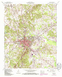
1965 Map of Paris
USGS Topo · Published 1986About this map
Paris serves as the focal point of this West Tennessee landscape, where the L & N RR and the Tennessee Valley Divide intersect. The town’s 1960s footprint is marked by civic and social pillars including the Courthouse, the Henry County General Hospital, and the Armory. Surrounding the urban center, the terrain is defined by a dense network of cemeteries and small rural settlements like Whitlock and India. Insights into the local economy are found in the scattered Strip mines and the industrial infrastructure of the L & N RR. Notable for genealogists is the variety of burial grounds, from the Oak Hill Cem (Jewish) to smaller family-named sites like Puckett Cem and Hansel Cem. The hydrologic character is shaped by the Middle Fork Obion River and numerous branches like Twomile Branch and Threemile Branch.
Find a feature on this map
84 named features on this map. Tap any name to fly to it.
Don’t see what you’re looking for? This feature index may not catch every label — zoom into the map to look around manually.
Map Details
Editions of this 1965 Paris Map
2 editions found
Other maps of this area

1936 · Conyersville
USGS Topo · 1:24,000

1936 · Buchanan
USGS Topo · 1:24,000

1936 · Crossland
USGS Topo · 1:24,000

1936 · Mansfield
USGS Topo · 1:24,000

1936 · Manleyville
USGS Topo · 1:24,000

1936 · Paris
USGS Topo · 1:24,000

1936 · Springville
USGS Topo · 1:24,000

1938 · Springville
USGS Topo · 1:24,000

1940 · Manleyville
USGS Topo · 1:24,000

1941 · Manleyville
USGS Topo · 1:24,000