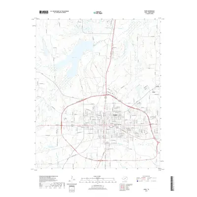
2019 Map of Paris
USGS Topo · Published 2019About this map
Paris sits at the heart of this North Texas landscape, framed by a complete loop of modern highway infrastructure. The city's grid is remarkably defined, extending outward from the historic center toward the outlying communities of Reno and Givens to the east. Water systems play a significant role in the local geography, with Lake Crook dominating the northern horizon and numerous tributaries like Crooked Creek and Pine Cr draining the surrounding plains.
Find a feature on this map
121 named features on this map. Tap any name to fly to it.
Don’t see what you’re looking for? This feature index may not catch every label — zoom into the map to look around manually.
Map Details
Editions of this 2019 Paris Map
This is the sole edition of this map. No revisions or reprints were ever made.
Other maps of this area

1903 · Paris
USGS Topo · 1:125,000

1948 · Grant
USGS Topo · 1:62,500

1948 · Paris
USGS Topo · 1:62,500

1949 · Grant
USGS Topo · 1:62,500

1949 · Paris
USGS Topo · 1:62,500

1951 · Slate Shoals
USGS Topo · 1:24,000

1953 · Texarkana
USGS Topo · 1:250,000

1956 · Texarkana
USGS Topo · 1:250,000

1964 · Pattonville
USGS Topo · 1:24,000

1964 · Blossom
USGS Topo · 1:24,000