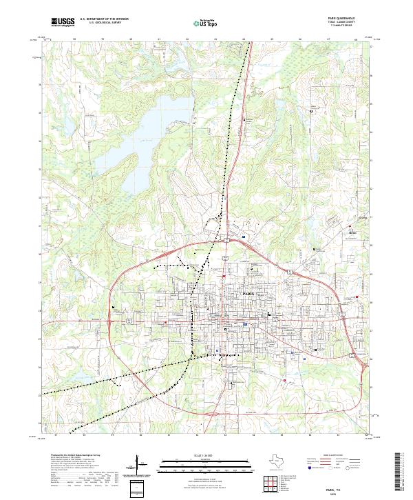
2022 Map of Paris
USGS Topo · Published 2022About this map
Lake Crook dominates the northern landscape above the city of Paris, a regional hub in Lamar County defined by its dense grid of streets and institutional landmarks. At the heart of the community stands the Lamar County Courthouse, surrounded by civic and historical sites such as the Old City Cem and the Holy Cross Columbarium. The map reveals a high concentration of burial grounds, including the Chisum Family Cem, Evergreen Cem, and the Odd Fellow Cem, providing a detailed record for genealogical study. To the southeast, the campus of Paris Junior College serves as a prominent educational anchor. The transition from the urban center to the outskirts is marked by smaller settlements like Givens and Reno, with local waterways such as Pine Cr and Big Sandy Cr meandering through the surrounding countryside and residential developments.
Find a feature on this map
197 named features on this map. Tap any name to fly to it.
Don’t see what you’re looking for? This feature index may not catch every label — zoom into the map to look around manually.
Map Details
Editions of this 2022 Paris Map
This is the sole edition of this map. No revisions or reprints were ever made.
Other maps of this area

1903 · Paris
USGS Topo · 1:125,000

1948 · Grant
USGS Topo · 1:62,500

1948 · Paris
USGS Topo · 1:62,500

1949 · Grant
USGS Topo · 1:62,500

1949 · Paris
USGS Topo · 1:62,500

1951 · Slate Shoals
USGS Topo · 1:24,000

1953 · Texarkana
USGS Topo · 1:250,000

1956 · Texarkana
USGS Topo · 1:250,000

1964 · Pattonville
USGS Topo · 1:24,000

1964 · Blossom
USGS Topo · 1:24,000