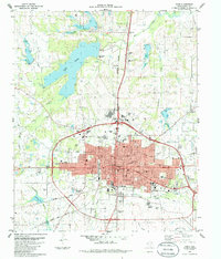
1984 Map of Paris
USGS Topo · Published 1985About this map
Paris serves as a major transportation and educational hub in Lamar County, centered around a dense grid of residential and commercial streets. The city is defined by a significant rail infrastructure, with the Missouri Pacific Railroad, Northern Burlington, and the Atchison Topeka and Santa Fe Railroad converging here. Notable civic landmarks include the Courthouse, hospital, and a series of neighborhood schools such as First Ward Sch and Fourth Ward Sch.
Find a feature on this map
50 named features on this map. Tap any name to fly to it.
Don’t see what you’re looking for? This feature index may not catch every label — zoom into the map to look around manually.
Map Details
Editions of this 1984 Paris Map
This is the sole edition of this map. No revisions or reprints were ever made.
Other maps of this area

1903 · Paris
USGS Topo · 1:125,000

1948 · Grant
USGS Topo · 1:62,500

1948 · Paris
USGS Topo · 1:62,500

1949 · Grant
USGS Topo · 1:62,500

1949 · Paris
USGS Topo · 1:62,500

1951 · Slate Shoals
USGS Topo · 1:24,000

1953 · Texarkana
USGS Topo · 1:250,000

1956 · Texarkana
USGS Topo · 1:250,000

1964 · Pattonville
USGS Topo · 1:24,000

1964 · Blossom
USGS Topo · 1:24,000