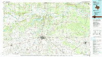
1991 Map of Paris
USGS Topo · Published 1991About this map
The Red River valley defines the border between Texas and Oklahoma in this detailed survey, anchored by the regional hub of Paris. The landscape is a network of small agricultural settlements and farm-to-market roads, including Powderly, Roxton, and Blossom. The presence of Camp Makey and the Gambill Wildlife Refuge indicates the varied land use of the late 20th century, balancing military training grounds with municipal conservation efforts.
Find a feature on this map
221 named features on this map. Tap any name to fly to it.
Don’t see what you’re looking for? This feature index may not catch every label — zoom into the map to look around manually.
Map Details
Editions of this 1991 Paris Map
This is the sole edition of this map. No revisions or reprints were ever made.
Other maps of this area

1899 · Atoka
USGS Topo · 1:125,000

1900 · Atoka
USGS Topo · 1:125,000

1901 · Antlers
USGS Topo · 1:125,000

1901 · Alikchi
USGS Topo · 1:125,000

1902 · Lukfata
USGS Topo · 1:125,000

1903 · Paris
USGS Topo · 1:125,000

1912 · Antlers
USGS Topo · 1:125,000

1925 · Antlers
USGS Topo · 1:125,000

1947 · Honey Grove
USGS Topo · 1:62,500

1948 · Grant
USGS Topo · 1:62,500