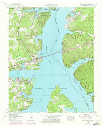
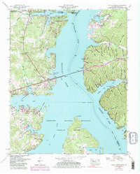
1950 Map of Paris Landing
USGS Topo · Published 1972About this map
The Tennessee River dominates this mid-century landscape, carving through the borderlands between Tennessee and Kentucky. The area is defined by the massive impoundment of Kentucky Lake, which flooded many lower-lying valleys and turned former uplands into the intricate shoreline seen at Paris Landing State Park. This recreation and conservation hub is flanked by the Tennessee National Migratory Wildlife Refuge, which spans the Big Sandy River confluence.
Find a feature on this map
78 named features on this map. Tap any name to fly to it.
Don’t see what you’re looking for? This feature index may not catch every label — zoom into the map to look around manually.
Map Details
Editions of this 1950 Paris Landing Map
5 editions found
Other maps of this area

1936 · Poplar Creek
USGS Topo · 1:24,000

1936 · Buchanan
USGS Topo · 1:24,000

1936 · Tharpe
USGS Topo · 1:24,000

1936 · New Concord
USGS Topo · 1:24,000

1936 · McKinnon
USGS Topo · 1:24,000

1936 · Hamlin
USGS Topo · 1:24,000

1936 · Centerville Landing
USGS Topo · 1:24,000

1936 · Standing Rock
USGS Topo · 1:24,000

1936 · Springville
USGS Topo · 1:24,000

1938 · Springville
USGS Topo · 1:24,000