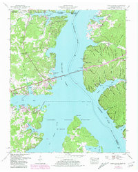
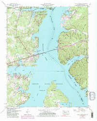
1950 Map of Paris Landing
USGS Topo · Published 1981About this map
Kentucky Lake dominates the central landscape of this mid-century survey, where the Tennessee River and Big Sandy River converge. The Scott Fitzhugh Bridge carries the Austin Peay Memorial Highway across the water, connecting the recreation areas of Paris Landing State Park with the rugged, hollow-cut terrain to the east. This eastern peninsula, defined by the Land Between the Lakes Boundary, is a maze of named drainages like Mint Spring Hollow and Causey Hollow.
Find a feature on this map
79 named features on this map. Tap any name to fly to it.
Don’t see what you’re looking for? This feature index may not catch every label — zoom into the map to look around manually.
Map Details
Editions of this 1950 Paris Landing Map
5 editions found
Other maps of this area

1936 · Poplar Creek
USGS Topo · 1:24,000

1936 · Buchanan
USGS Topo · 1:24,000

1936 · Tharpe
USGS Topo · 1:24,000

1936 · New Concord
USGS Topo · 1:24,000

1936 · McKinnon
USGS Topo · 1:24,000

1936 · Hamlin
USGS Topo · 1:24,000

1936 · Centerville Landing
USGS Topo · 1:24,000

1936 · Standing Rock
USGS Topo · 1:24,000

1936 · Springville
USGS Topo · 1:24,000

1938 · Springville
USGS Topo · 1:24,000