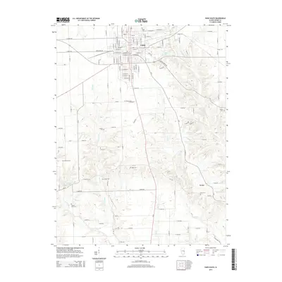
2015 Map of Paris South
USGS Topo · Published 2015About this map
Paris sits at the northern edge of this agricultural landscape in Edgar County, where the grid of city streets gives way to a network of rural section roads and winding waterways. The town's southern expansion is bounded by Eads Lake and the former path of Railroad St, while the surrounding countryside is defined by the drainages of the East Fork and Clear Cr. This area is particularly notable for its high density of family and community burial grounds, preserving the genealogy of early settlers through sites like Swango Cem, Lycan Cem, and Elledge Holley Cem. The small settlement of Nevins appears in the southeast, situated near McCalls Br, reflecting the scattered nature of rural development in the region. The map reveals how the modern road system, including E Sulphur Springs Rd, follows the subtle contours of the Illinois prairie.
Find a feature on this map
108 named features on this map. Tap any name to fly to it.
Don’t see what you’re looking for? This feature index may not catch every label — zoom into the map to look around manually.
Map Details
Editions of this 2015 Paris South Map
This is the sole edition of this map. No revisions or reprints were ever made.
Other maps of this area

1932 · Marshall
USGS Topo · 1:62,500

1936 · Casey
USGS Topo · 1:48,000

1937 · Marshall
USGS Topo · 1:62,500

1942 · Dennison
USGS Topo · 1:24,000

1942 · Casey
USGS Topo · 1:62,500

1943 · Casey
USGS Topo · 1:62,500

1946 · Kansas
USGS Topo · 1:62,500

1947 · Paris
USGS Topo · 1:62,500

1949 · Kansas
USGS Topo · 1:62,500

1949 · Paris
USGS Topo · 1:62,500