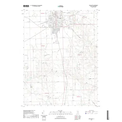
2018 Map of Paris South
USGS Topo · Published 2018About this map
Paris serves as the focal point of this Illinois survey, illustrating its established grid and residential growth south of the town center. The landscape transitions from urban streets like E Wood St and E Jasper St into a rural expanse defined by a dense concentration of family and community burial grounds. These small cemeteries, including Lycan Cem, Cassady Cem, and Swango Cem, are scattered across the township lines of t14n r12w and t13n r12w, marking the ancestral heritage of the surrounding farmland.
Find a feature on this map
75 named features on this map. Tap any name to fly to it.
Don’t see what you’re looking for? This feature index may not catch every label — zoom into the map to look around manually.
Map Details
Editions of this 2018 Paris South Map
This is the sole edition of this map. No revisions or reprints were ever made.
Other maps of this area

1932 · Marshall
USGS Topo · 1:62,500

1936 · Casey
USGS Topo · 1:48,000

1937 · Marshall
USGS Topo · 1:62,500

1942 · Dennison
USGS Topo · 1:24,000

1942 · Casey
USGS Topo · 1:62,500

1943 · Casey
USGS Topo · 1:62,500

1946 · Kansas
USGS Topo · 1:62,500

1947 · Paris
USGS Topo · 1:62,500

1949 · Kansas
USGS Topo · 1:62,500

1949 · Paris
USGS Topo · 1:62,500