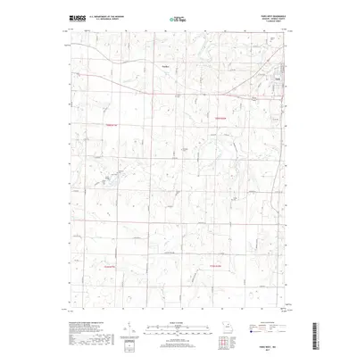
2017 Map of Paris West
USGS Topo · Published 2017About this map
The Middle Fork Salt River and Elk Fork Salt River converge in this section of Monroe County, shaping a landscape defined by deep drainages and rural farmstead crossings. Near the western edge of Paris, the street grid extends to N Main St and Cleveland St, while the surrounding countryside is dotted with legacy burial grounds. These family and community sites, including McKinney Cem and Union Cem, are often situated near creek bluffs or tucked along county roads like Co RD 956. The historic Union Bridge provides a concrete point of interest for those tracing the development of local infrastructure along the river forks. In the northern reaches, the small settlement of Fowkes sits near Bakers Pond, serving as a quiet waypoint in the agricultural uplands between the larger river valleys.
Find a feature on this map
73 named features on this map. Tap any name to fly to it.
Don’t see what you’re looking for? This feature index may not catch every label — zoom into the map to look around manually.
Map Details
Editions of this 2017 Paris West Map
This is the sole edition of this map. No revisions or reprints were ever made.
Other maps of this area

1890 · Mexico
USGS Topo · 1:125,000

1890 · Moberly
USGS Topo · 1:125,000

1903 · Palmyra
USGS Topo · 1:125,000

1945 · Florida
USGS Topo · 1:62,500

1948 · Quincy
USGS Topo · 1:250,000

1953 · Moberly
USGS Topo · 1:250,000

1954 · Moberly
USGS Topo · 1:250,000

1956 · Quincy
USGS Topo · 1:250,000

1957 · Moberly
USGS Topo · 1:250,000

1958 · Tulip
USGS Topo · 1:24,000