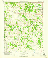
1960 Map of Paris West
USGS Topo · Published 1961About this map
The Middle Fork Salt River and Elk Fork Salt River converge in this section of Monroe County, defining a landscape of winding watercourses and small rural communities. The town of Paris sits at the eastern edge, served by the Wabash railroad line which cuts across the northern territory. Local life in the early 1960s is anchored by scattered landmarks like the Drive-in Theater and numerous country churches, including Mt Zion Ch and St Francis Cabrini Ch.
Find a feature on this map
29 named features on this map. Tap any name to fly to it.
Don’t see what you’re looking for? This feature index may not catch every label — zoom into the map to look around manually.
Map Details
Editions of this 1960 Paris West Map
4 editions found
Other maps of this area

1890 · Mexico
USGS Topo · 1:125,000

1890 · Moberly
USGS Topo · 1:125,000

1903 · Palmyra
USGS Topo · 1:125,000

1945 · Florida
USGS Topo · 1:62,500

1948 · Quincy
USGS Topo · 1:250,000

1953 · Moberly
USGS Topo · 1:250,000

1954 · Moberly
USGS Topo · 1:250,000

1956 · Quincy
USGS Topo · 1:250,000

1957 · Moberly
USGS Topo · 1:250,000

1958 · Tulip
USGS Topo · 1:24,000