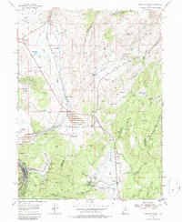
1955 Map of Park City East
USGS Topo · Published 1987About this map
Mining operations and early ski infrastructure define this mid-century landscape where Park City meets the Union Pacific rail lines. The industrial character of the era is evident through numerous shafts and mines, including the Queen Esther Shaft, Constellation Shaft, and the Park City Consolidated works. These extractive sites are concentrated near Masonic Hill and Deer Valley, where the presence of the Snow Pack Ski Lifts signals the beginning of the area's transition into a recreation destination.
Find a feature on this map
66 named features on this map. Tap any name to fly to it.
Don’t see what you’re looking for? This feature index may not catch every label — zoom into the map to look around manually.
Map Details
Editions of this 1955 Park City East Map
5 editions found
Other maps of this area

1885 · Salt Lake
USGS Topo · 1:250,000

1900 · Coalville
USGS Topo · 1:125,000

1903 · Coalville
USGS Topo · 1:125,000

1925 · Ft. Douglas
USGS Topo · 1:125,000

1928 · Ft. Douglas
USGS Topo · 1:125,000

1954 · Salt Lake City
USGS Topo · 1:250,000

1955 · Heber
USGS Topo · 1:24,000

1955 · Park City East
USGS Topo · 1:24,000

1955 · Brighton
USGS Topo · 1:24,000

1955 · Park City West
USGS Topo · 1:24,000