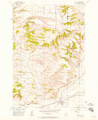
1956 Map of Park City
USGS Topo · Published 1958About this map
Park City sits at the southern edge of this mid-century landscape, positioned where the rugged upland breaks of Coombs Flat and Miller Butte descend toward the valley floor. This 1956 field-checked survey reveals an intricate irrigation network essential to the local agricultural economy, specifically the Big Cove Ditch and Old Mill Ditch which parallel the Northern Pacific railroad tracks.
Find a feature on this map
18 named features on this map. Tap any name to fly to it.
Don’t see what you’re looking for? This feature index may not catch every label — zoom into the map to look around manually.
Map Details
Editions of this 1956 Park City Map
2 editions found
Other maps of this area

1892 · Stillwater
USGS Topo · 1:125,000

1954 · Billings
USGS Topo · 1:250,000

1956 · Hunter Lake
USGS Topo · 1:24,000

1956 · Horse Butte
USGS Topo · 1:24,000

1956 · Molt
USGS Topo · 1:24,000

1956 · Silesia
USGS Topo · 1:24,000

1956 · Rapids
USGS Topo · 1:24,000

1956 · Two Pine School
USGS Topo · 1:24,000

1956 · Laurel
USGS Topo · 1:24,000

1956 · Park City
USGS Topo · 1:24,000