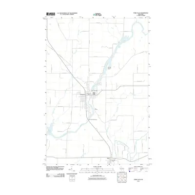
2010 Map of Park Falls
USGS Topo · Published 2010About this map
The Flambeau River dictates the landscape of this Price County region, winding past the industrial and residential core of Park Falls. Hydroelectric infrastructure is a prominent feature of the local river economy, seen here through the Upper Hydro Dam and the Lower Hydro WP183 Dam near the town center. The settlement of Lymantown sits just west of the main river channel, while further south, the South Fork Flambeau River converges near Fifield and the Cummings Dam.
Find a feature on this map
52 named features on this map. Tap any name to fly to it.
Don’t see what you’re looking for? This feature index may not catch every label — zoom into the map to look around manually.
Map Details
Editions of this 2010 Park Falls Map
This is the sole edition of this map. No revisions or reprints were ever made.
Other maps of this area

1940 · Butternut
USGS Topo · 1:48,000

1941 · Park Falls
USGS Topo · 1:48,000

1941 · Kennedy
USGS Topo · 1:48,000

1942 · Glidden
USGS Topo · 1:48,000

1943 · Park Falls
USGS Topo · 1:48,000

1945 · Kennedy
USGS Topo · 1:48,000

1945 · Glidden
USGS Topo · 1:48,000

1947 · Park Falls
USGS Topo · 1:48,000

1947 · Butternut
USGS Topo · 1:48,000

1950 · Butternut
USGS Topo · 1:48,000