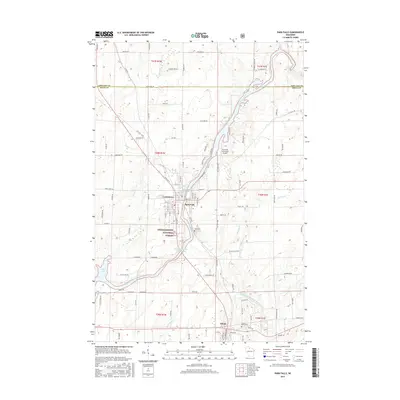
2015 Map of Park Falls
USGS Topo · Published 2015About this map
The Flambeau River defines the industrial and geographic character of this Price County region, flowing through the heart of Park Falls and down toward Fifield. In this modern 2015 survey, the river is harnessed by the Upper Park Falls Flowage (60) and Lower Park Falls Flowage (62), marking the site of historic hydroelectric development and paper milling that sustained the local economy for over a century. To the west of the main settlement, the smaller neighborhood of Lymantown sits near the winding Smith Cr.
Find a feature on this map
108 named features on this map. Tap any name to fly to it.
Don’t see what you’re looking for? This feature index may not catch every label — zoom into the map to look around manually.
Map Details
Editions of this 2015 Park Falls Map
This is the sole edition of this map. No revisions or reprints were ever made.
Other maps of this area

1940 · Butternut
USGS Topo · 1:48,000

1941 · Park Falls
USGS Topo · 1:48,000

1941 · Kennedy
USGS Topo · 1:48,000

1942 · Glidden
USGS Topo · 1:48,000

1943 · Park Falls
USGS Topo · 1:48,000

1945 · Kennedy
USGS Topo · 1:48,000

1945 · Glidden
USGS Topo · 1:48,000

1947 · Park Falls
USGS Topo · 1:48,000

1947 · Butternut
USGS Topo · 1:48,000

1950 · Butternut
USGS Topo · 1:48,000