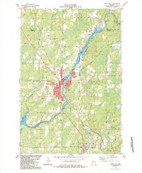
1984 Map of Park Falls
USGS Topo · Published 1984About this map
The industrial and civic heart of Park Falls centers on the powerful Flambeau River, where a Powerplant and various municipal services anchor the community. By the mid-1980s, the town's layout reflects a mature Northwoods settlement, with residential clusters in Lymantown and infrastructure like the Municipal Airport and Hospital supporting the local population. The Soo Line railroad bisects the landscape, providing a critical transportation link through the town and southward toward Fifield.
Find a feature on this map
35 named features on this map. Tap any name to fly to it.
Don’t see what you’re looking for? This feature index may not catch every label — zoom into the map to look around manually.
Map Details
Editions of this 1984 Park Falls Map
This is the sole edition of this map. No revisions or reprints were ever made.
Other maps of this area

1940 · Butternut
USGS Topo · 1:48,000

1941 · Park Falls
USGS Topo · 1:48,000

1941 · Kennedy
USGS Topo · 1:48,000

1942 · Glidden
USGS Topo · 1:48,000

1943 · Park Falls
USGS Topo · 1:48,000

1945 · Kennedy
USGS Topo · 1:48,000

1945 · Glidden
USGS Topo · 1:48,000

1947 · Park Falls
USGS Topo · 1:48,000

1947 · Butternut
USGS Topo · 1:48,000

1950 · Butternut
USGS Topo · 1:48,000