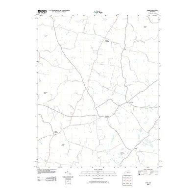
2010 Map of Park
USGS Topo · Published 2010About this map
Seymour and LeGrande serve as central nodes in this Hart County landscape, where rural life is organized around a complex network of named country roads and local knobs. The terrain is defined by several prominent elevations, including Allison Knob in the northeast and Wootens Knob to the west, while Blue Spring Creek meanders through the southeastern portion of the quadrangle.
Find a feature on this map
39 named features on this map. Tap any name to fly to it.
Don’t see what you’re looking for? This feature index may not catch every label — zoom into the map to look around manually.
Map Details
Editions of this 2010 Park Map
This is the sole edition of this map. No revisions or reprints were ever made.
Other maps of this area

1934 · Munfordville
USGS Topo · 1:48,000

1935 · Horse Cave
USGS Topo · 1:48,000

1937 · Munfordville
USGS Topo · 1:62,500

1938 · Horse Cave
USGS Topo · 1:62,500

1953 · Sulphur Well
USGS Topo · 1:24,000

1953 · Hudgins
USGS Topo · 1:24,000

1953 · Munfordville
USGS Topo · 1:24,000

1953 · Center
USGS Topo · 1:24,000
1953 · Canmer
USGS Topo · 1:24,000

1954 · Park
USGS Topo · 1:24,000