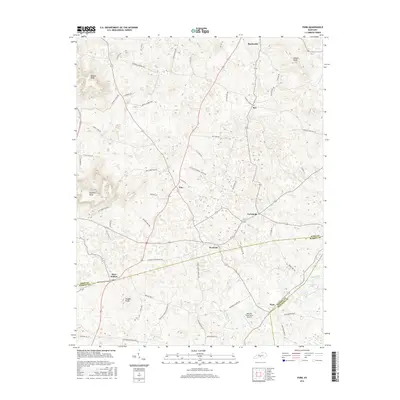
2016 Map of Park
USGS Topo · Published 2016About this map
Hardyville and the surrounding rural landscape of Hart County are defined by a complex network of country lanes and named knolls in this mid-2010s survey. The terrain is characterized by distinctive high points such as Dawson Knob and Wootens Knob, with the prominent Wallow Ridge cutting through the center of the quadrangle. Small, historically significant settlements like Uno, LeGrande, and Bear Wallow are connected by a web of local routes including Roy Cann Rd and Bunnell Crossing Rd.
Find a feature on this map
55 named features on this map. Tap any name to fly to it.
Don’t see what you’re looking for? This feature index may not catch every label — zoom into the map to look around manually.
Map Details
Editions of this 2016 Park Map
This is the sole edition of this map. No revisions or reprints were ever made.
Other maps of this area

1934 · Munfordville
USGS Topo · 1:48,000

1935 · Horse Cave
USGS Topo · 1:48,000

1937 · Munfordville
USGS Topo · 1:62,500

1938 · Horse Cave
USGS Topo · 1:62,500

1953 · Sulphur Well
USGS Topo · 1:24,000

1953 · Hudgins
USGS Topo · 1:24,000

1953 · Munfordville
USGS Topo · 1:24,000

1953 · Center
USGS Topo · 1:24,000
1953 · Canmer
USGS Topo · 1:24,000

1954 · Park
USGS Topo · 1:24,000