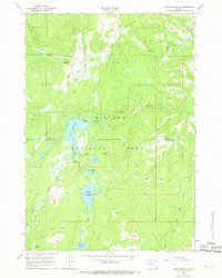
1965 Map of Park Reservoir
USGS Topo · Published 1968About this map
Bighorn National Forest serves as the backdrop for this mid-1960s study of the high mountain drainages between Sheridan and Johnson counties. The landscape is defined by an intricate network of water management and seasonal recreation, centered on the Park Reservoir and the Bighorn Reservoir. These high-altitude catchments are linked by historic engineering features like the Beaver Ditch, Park Reservoir Div Ditch, and Peralta Ditch, reflecting the critical importance of water rights and irrigation in the region.
Find a feature on this map
50 named features on this map. Tap any name to fly to it.
Don’t see what you’re looking for? This feature index may not catch every label — zoom into the map to look around manually.
Map Details
Editions of this 1965 Park Reservoir Map
2 editions found
Other maps of this area

1895 · Dayton
USGS Topo · 1:125,000

1899 · Cloud peak
USGS Topo · 1:125,000

1901 · Cloud Peak
USGS Topo · 1:125,000

1901 · Dayton
USGS Topo · 1:125,000

1955 · Sheridan
USGS Topo · 1:250,000

1958 · Sheridan
USGS Topo · 1:250,000

1960 · Shell Lake
USGS Topo · 1:24,000

1962 · Sheridan
USGS Topo · 1:250,000

1964 · Walker Mountain
USGS Topo · 1:24,000

1964 · Beckton
USGS Topo · 1:24,000