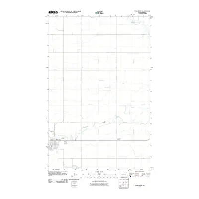
2011 Map of Park River
USGS Topo · Published 2011About this map
Park River serves as the primary hub of activity in this part of Walsh County, where the town's grid is defined by streets like 4th St E, 7th St E, and Railroad Ave W. The surrounding landscape is dominated by the meandering paths of the Middle Branch Park River and the South Branch Park River, which cut through a strictly organized section-line road network. This alignment of natural watercourses against a rigid agrarian grid is typical of the Red River Valley’s development.
Find a feature on this map
34 named features on this map. Tap any name to fly to it.
Don’t see what you’re looking for? This feature index may not catch every label — zoom into the map to look around manually.
Map Details
Editions of this 2011 Park River Map
This is the sole edition of this map. No revisions or reprints were ever made.
Other maps of this area

1944 · Crystal
USGS Topo · 1:62,500

1952 · Thief River Falls
USGS Topo · 1:250,000

1956 · Thief River Falls
USGS Topo · 1:250,000

1957 · Thief River Falls
USGS Topo · 1:250,000

1963 · Crystal SE
USGS Topo · 1:24,000

1963 · Crystal
USGS Topo · 1:24,000

1963 · Edinburg
USGS Topo · 1:24,000

1963 · Pleasant Valley
USGS Topo · 1:24,000

1963 · Gardar
USGS Topo · 1:24,000

1963 · Pisek
USGS Topo · 1:24,000