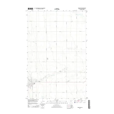
2014 Map of Park River
USGS Topo · Published 2014About this map
Park River serves as the primary hub in this portion of Walsh County, situated where ND-17 meets a network of local roads. The landscape is defined by the winding paths of the S Br Park River and the Middle Br Park River, which cut through the agricultural grid. Local history is deeply rooted in several community landmarks, including Hyde Park Cem and Kensington Cem, reflecting the area's long-established settlement. The inclusion of the Walser Strip Airport north of the main town provides insight into the region's reliance on private aviation for rural connectivity. Outside the town center, the map illustrates a transition from residential streets like Veterans Ave S to the expansive section lines of the North Dakota prairie.
Find a feature on this map
32 named features on this map. Tap any name to fly to it.
Don’t see what you’re looking for? This feature index may not catch every label — zoom into the map to look around manually.
Map Details
Editions of this 2014 Park River Map
This is the sole edition of this map. No revisions or reprints were ever made.
Other maps of this area

1944 · Crystal
USGS Topo · 1:62,500

1952 · Thief River Falls
USGS Topo · 1:250,000

1956 · Thief River Falls
USGS Topo · 1:250,000

1957 · Thief River Falls
USGS Topo · 1:250,000

1963 · Crystal SE
USGS Topo · 1:24,000

1963 · Crystal
USGS Topo · 1:24,000

1963 · Edinburg
USGS Topo · 1:24,000

1963 · Pleasant Valley
USGS Topo · 1:24,000

1963 · Gardar
USGS Topo · 1:24,000

1963 · Pisek
USGS Topo · 1:24,000